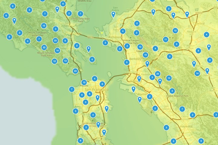
AllTrails is one of the most comprehensive guides to the outdoors accessible from your smartphone, offering more than 50,000 trail maps and boasting more than six million registered users. The company’s goal is to provide you with all the tools you need to hit the trails, encouraging you to get outdoors. The application registers your location and provides you with nearby trailheads, including driving directions that when downloaded continue to work offline. Map overlays allow you to see topography, satellite, and other layers that provide information about each trail — now including air quality.
AllTrails Pro users can now select their hike, run, or bike ride taking air quality into consideration on account of a partnership with BreezoMeter and the development of a color-coded air pollution map. BreezoMeter gives companies accurate pollutant concentrations and forecast using government sensors, weather, and other tools, serving as the world leader in hyperlocal real-time air quality data.
“With air pollution becoming an increased health concern, this data is integral to informing our users of local air quality conditions and keeping outdoor enthusiasts healthy while out on the trails,” stated AllTrails CMO Ron Schneidermann in a news release.
Air quality is a dynamic factor, changing throughout the day depending on traffic, weather, environmental factors, and other natural events, necessitating the need for an adaptable map overlay. BreezoMeter’s algorithms change regularly, taking into account 17 different pollutants and three different types of pollen. The air quality map overlay shows users which areas are heavily polluted and should be avoided depending on the time of day, so that you can hit the trails and breathe easier (literally).
AllTrails Pro is available as an annual subscription for $30 per year on iOS and Android.

