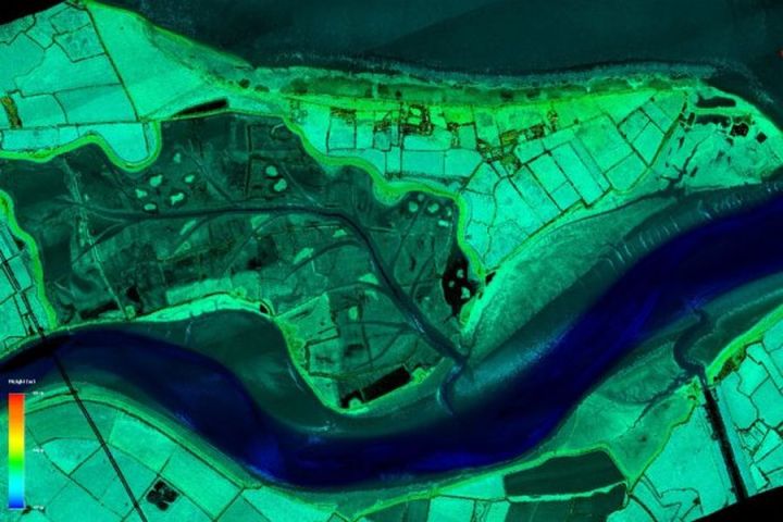
Within the next three years, England will use light detection and ranging (LIDAR) to survey the entirety of the country at one-meter resolution. LIDAR imaging has been an ongoing process for nearly 20 years in an effort to reduce flood risk. At present, about 75 percent of the country has been mapped, but the coverage is sparse in unpopulated areas and national parks.
All the data will also be available free to the public, as is the case with the current LIDAR data. In the past two years, users made more than a half-million LIDAR downloads from the Survey Open Data site.
“I’m pleased we are able to gather, use and share such valuable data to contribute to environmental improvements and conservation,” said Sir James Beven, chief executive of the agency. “It’s just one of the many ways the Environment Agency is using technology to help people and wildlife.”
In addition to urban planners and environmentalists assessing impacts of weather, the data can also be used in a variety of ways, such as game developers wishing to make accurate models of the countryside, or creating a 3D sculpture of the city of London. In 2016, for example, archaeologists used the LIDAR images to discover ancient Roman roads that had been “lost” for centuries.
The survey maps are created by planes equipped with laser scanners, which measure the distance between the aircraft and the ground. At present, about 40 percent of the country is either not surveyed, or has only been mapped at two meters resolution, or the survey is more than 10 years old.
The newer LIDAR technology allows planes to fly at a higher altitude, which covers larger areas more consistently and results in a higher quality digital terrain model. Most of the surveying will be done during wintertime, when the lack of tree leaves means the laser pulses can reach the ground.
Beven says the project has many benefits. “This ambitious project will enhance our understanding of England’s unique natural features and landscape, helping us to better understand flood risk, plan effective defenses and fight waste crime.”


