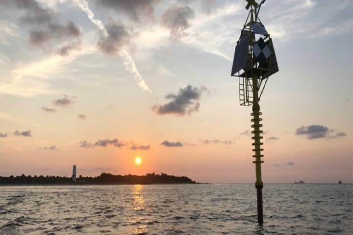
Buoys, the flotation devices most commonly found at sea, can be used for a variety of purposes — ranging from showing safe water areas to marking routes for waterborne racecourses. Throughout 2019, however, geoscientists from the University of South Florida have been using a new high-tech version to see if it could be used to help predict impending natural hazards, such as earthquakes, volcanoes, and tsunamis. They believe that it can.
This shallow water buoy was developed using an $822,000 grant from the National Science Foundation. It currently sits off Florida’s Egmont Key in the Gulf of Mexico, where it produces data on the three-dimensional motion of the seabed by sensing tiny movements and changes on the seafloor. While Florida is not an area that’s prone to earthquakes, the Egmont Key location serves as a good test location for the technology. If it could ultimately be used to better forecast events like the giant earthquakes and tsunamis in Sumatra in 2004 and Japan in 2011, this would be money very well spent.
“This is a [tool] for doing seafloor geodesy in the shallow continental shelf environment,” Tim Dixon, a distinguished professor in the USF School of Geosciences, told Digital Trends. “Geodesy aims to measure position, displacement, or strain, to very high precision — a few millimeters averaged over a 24-hour period. We do this routinely on land using a special type of high-precision GPS receiver. Our technique extends this capability to the shallow seafloor by using a rigid spar buoy, connected to a heavy anchor on the seafloor.”
The buoy’s orientation is measured using a digital compass. These special tilt and orientation sensors provide heading, pitch, and roll information. The device also contains a GPS receiver, solar panels, batteries, and an Iridium data transmitter.
“The buoy has been in the water now for more than a year, and has weathered several tropical storms and a hurricane,” Dixon said. “It has performed well, pretty much in line with our expectations. The next step is to design, build and test a deeper water version. We hope to submit a new proposal soon to the U.S. National Science Foundation to support that work.”
A paper describing the project was recently published in the Journal of Geophysical Research-Solid Earth.


