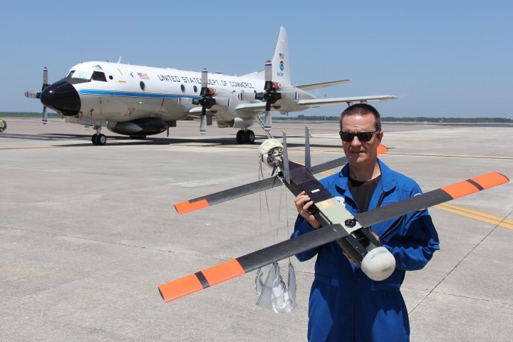
If you’re not familiar, Hurricane Hunters are aircraft that fly into the worst weather imaginable: the turbulent skies of tropical storms and hurricanes. The data they collect is invaluable, and helps forecasters understand the strength of these massive weather events from tens of thousands of feet in the air. To get a better idea of what’s happening at the surface, they rely on dropping packages of sensors, called dropsondes.
There’s a problem with that, though: physics and the fluid nature of our atmosphere tells you that dropping something into strong winds makes it difficult to pinpoint where it’s going to reach the surface. Since forecasters are most interested in knowing what’s happening with hurricanes closest to the center — where winds are strongest and the pressure lowest — this isn’t the best solution.
This is where drones come in. Because of their small size, they’re able to fly at much, much lower altitudes than standard sized aircraft. The NOAA’s “Coyote,” as it’s called, attaches to the bottom of the Hurricane Hunter aircraft and launches when the aircraft is close to the center of the storm.

Coyote already has real-world testing under its belt: in 2014, prototypes were flown in Hurricane Edouard as low as 400 feet, successfully collecting real-time data on atmospheric air pressure, temperature, moisture, wind speed and direction as well as surface temperature.
January’s tests were aimed at improving Coyote, enabling it to fly longer and further away from the aircraft. Tests confirmed that the drone’s operators could successfully receive data as far as 50 miles away, a nearly eight-fold increase over the drones that flew into Edouard. They also successfully tested a new infrared sensor aimed at measuring sea-surface temperatures.
That was one of the biggest breakthroughs, as a more thorough understanding of ocean temperatures underneath a hurricane is crucial. If sea-surface temperatures are warmer than anticipated, a hurricane might have extra fuel to cause an unexpected burst in strength, and cooler might portend a weakening storm.
NOAA is pleased with Coyote’s performance so far. “This successful flight gives us additional confidence that we will be able to use this unique platform to collect critical continuous observations at altitudes in the lower part of a hurricane, an area that would otherwise be impossible to reach with manned aircraft,” NOAA researcher Joe Cione says.
Meteorologists are salivating at the opportunity for additional data where traditionally there has been a hole, or at best, estimates of what they’d expect to be occurring based on the current state of the science. The data will be ingested into weather models to improve intensity forecasting, and will improve accuracy of current storm strength.
“Coyote could help us paint a better picture of current storm intensity for our storm updates,” the National Hurricane Center’s science operations officer Chris Landsea says.
NOAA has not specified any time frame when it expects Coyote to see regular use in Hurricane Hunter flights, although it seems likely more real-world tests will occur during the 2016 Atlantic hurricane season.


