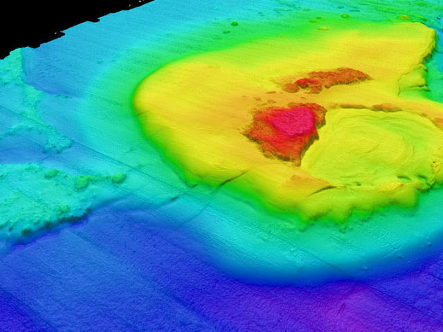
Could this also effect how the waves of future storms react? That’s what they’re trying to find out. Researchers liken the ripples to fingerprints, and doctoral student Carter DuVal said they might not only help researchers identify and understand past storms, but help predict the effects of future storms, too.
DuVal developed an algorithm that predicts how these seafloor ripples will form in major storms, such as 2012’s Superstorm Sandy. Working with associate professor Art Trembanis and other researchers, DuVal was able to get real-world data after Sandy, and found that currents moved as fast as 5.2 meters per second on the ocean floor.
Why is understanding these ripples important? Trembanis points to storm surge. In order for scientists to more accurately predict storm surge, they first must understand how the ocean behaves as it passes over the Continental Shelf.
The Continental Shelf is a region of relatively shallower water that extends out from the East Coast as far as 250 miles. As storms — and their associated waves — move on to the shelf, the waves grow higher, and how high they can go and how much energy they have depends a great deal on the topography of the ocean floor below.
“At practical levels, if we are going to appropriately predict and model how storms are going to behave, we need to be able to determine ripple parameters, such as wavelength and orientation to the shoreline, with accuracy,” Trembanis said.
A better understanding of how these ripples in the seafloor change will result in better predictions of storm surge and overwash onshore, since the energy of these waves play a large part in their destructive power. The fingerprint algorithm allows researchers to study the ocean floor and thus make better predictions of potential wave action.
“It gives you a perspective that you cannot get by looking at a two- or three-dimensional map on a screen,” DuVal said. “Not only can we look at the surface, but also the texture.”
While Sandy was an exceptional storm, the wave action it produced is not all that unusual. Trembanis says the wave-energy levels of Sandy reoccur every two-and- a-half to three years, and February’s Winter Storm Jonas had even higher energy levels, creating even larger ripples.
The study is not over, and DuVal and Trembanis expect to continue to study the ripples. In time and with enough data, they might also begin to better understand the effects on storm surge as well.


