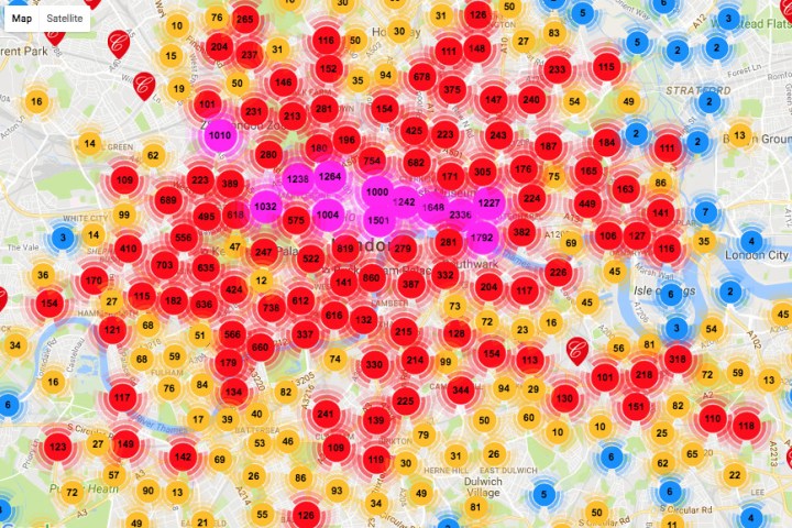
Keen to share some of its fascinating story with both locals and faraway fans, the City of London’s Picture Archive has just launched a brand new interactive map that lets you search and view images of the capital going back hundreds of years.
The London Picture Map is an impressive piece of work that includes content not only for the city’s more famous points of interest in the center, but also for all 32 of its boroughs extending north, south, east, and west.
At the current time, visitors to the site can search more than a quarter of a million historical images of the city, while around 100,000 have so far been placed on the map, allowing you to browse the collection geographically.
“It’s a great way to discover images of a particular street or building,” the City of London says on its website. “Many of the images which we have placed on the map are of buildings that no longer exist, giving you an intriguing view of ‘Lost London.'”
The map’s compilers are constantly updating it with new images, which include photos as well as drawings, paintings, posters, and film clips.
The site is a breeze to use. Loading the map presents the viewer with thousands of numbered circles, indicating the location and number of images available to view. Simply zoom in to a particular area of interest to see the precise spot for which content is available, and click on a circle to view the material.
“The red ‘C’ markers represent one image,” the site explains. “The blue markers represent a group of less than 10 images in close proximity, the yellow markers represent a group of less than 100 images in close proximity and the red markers with numbers represent groups of more than 100 images in close proximity.” Hit the “browse results” button top right at any time to jump to the images currently indicated by the markers. You can also refine the search – for example choosing photos only – using the boxes down the left side of the page.
Of course, with the city’s landscape in a permanent state of flux, the site notes that images of streets and buildings that no longer exist can sometimes be difficult to place and therefore are marked as “approximate.”
For anyone with even a passing interest in London’s history, or simply with a fascination for our fast-changing times, a few hours spent browsing the London Picture Map really is a no-brainer.


