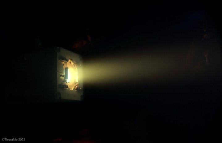
This iodine satellite propulsion system could help reduce space debris

A depiction of the iodine thruster developed by ThrustMe being used to change the orbit of a small satellite.
A depiction of the iodine thruster developed by ThrustMe being used to change the orbit of a small satellite. ThrustMe
Promotional image for Tech For Change. Person standing on solar panel looking at sunset.
This story is part of Tech for Change: an ongoing series in which we shine a spotlight on positive uses of technology, and showcase how they're helping to make the world a better place.

One of the contributing factors to the ever-increasing problem of space debris is the rising number of small satellites being launched. When these satellites fail or are no longer needed, they are often left to float in their orbits, clogging up the space around our planet with potentially dangerous junk.

Some proposed solutions to this problem include schemes to capture and dispose of debris. But another approach is to create less debris in the future, by equipping satellites with technology so they can be destroyed when no longer needed. The European Space Agency (ESA) recently reported that an iodine thruster system has been used for the first time to do just that: Adjusting the orbit of a small satellite.

Recommended Videos

The idea is that when a satellite reaches the end of its life, it can self-destruct by using a thruster to change its orbit so it falls into the atmosphere and burns up. With the satellite burnt up, it wouldn’t leave debris in its old orbit.

Please enable Javascript to view this content

The thruster technology is developed by a French company called ThrustMe, and is unusual in its use of iodine as a propellant. Iodine is cheaper than other propellants and is also non-toxic and stable, which makes it easier and simpler to work with. “When heated, it turns to gas without going through a liquid phase, which makes it ideal for a simple propulsion system,” ESA explains. “It is also denser than traditional propellants, so it occupies smaller volumes onboard the satellite.”

The first satellite to be moved using this iodine propulsion method was a telecommunications nanosat called SpaceTy Beihangkongshi-1. It was launched in November 2020 on a CZ-6 Long March 6 rocket from Taiyuan, China. To see whether the propellant system would work, it was test-fired earlier this month. With everything looking good, it was then used to actually move the orbit of the satellite.

In the future, similar systems could be attached to small satellites relatively cheaply, allowing them to self-destruct when no longer required and thus reducing space debris.

Georgina Torbet
Georgina has been the space writer at Digital Trends space writer for six years, covering human space exploration, planetary…
The search for habitable moons in the solar system is heating up
During a 2005 flyby, NASA’s Cassini spacecraft took high-resolution images of Enceladus that were combined into this mosaic, which shows the long fissures at the moon’s south pole that allow water from the subsurface ocean to escape into space.

In the search for life beyond Earth, one of the most exciting potential locations to explore is Saturn's icy moon Enceladus. With its thick icy crust covering a liquid water ocean, the moon is notable both for the plumes of water spraying from its surface and the fact that it could potentially support life. Now, the search for habitable environments is heating up as astronomers discovered that Enceladus hosts phosphorus, which is an important element for life.

The research used data from the Cassini mission, which performed multiple flybys of Enceladus in the mid-2000s, investigating the water plumes and cryovolcanoes that dot its surface. The spacecraft also flew through one of the outer rings of Saturn, which carries particles that are sent out by the Enceladus plumes. While much of the Cassini data has been studied extensively, this new research is the first time that phosphorus has been detected in it.

Read more
Hubble scientists create tool for erasing satellite trails from images
This image captures the streak of an Earth-orbiting artificial satellite crossing Hubble's field of view during an observation of "The Mice" interacting galaxies (NGC 4676). A typical satellite trail is very thin and will affect less than 0.5% of a single Hubble exposure. Though in this case the satellite overlaps a portion of the target galaxy, the observation quality is not affected. That's because multiple exposures are taken of the same target. And the satellite trail is not in other frames. Developers at the Space Telescope Science Institute in Baltimore, Maryland, have software that identifies the bad pixels from the satellite photobombing, the extent to which they affect the image, and then flags them. When flagged, scientists can recover the full field of view. Even as the number of satellites increases over the decade, these tools for cleaning the images will still be applicable.

With ever-increasing numbers of satellites in the sky, astronomers have repeatedly expressed worry over how these satellites could impact scientific research. Earlier this year, a study of Hubble Space Telescope observations showed how some images were being ruined by streaks of light coming from satellites -- and while only a small percentage of Hubble images were affected, the authors raised concerns that with the projected number of satellites set to explode in the next decade, the problem could become serious.

Now, astronomers at the Space Telescope Science Institute (STScI), which runs Hubble, have come up with a tool to deal with satellite streaks in Hubble images. "We developed a new tool to identify satellite trails that is an improvement over the previous satellite software because it is much more sensitive. So we think it will be better for identifying and removing satellite trails in Hubble images," said Dave Stark of STScI in a statement.

Read more
See the first image of Earth from a new weather-monitoring satellite
First image of the full Earth disc from the Meteosat Third Generation Imager. The first image from Meteosat Third Generation – Imager 1 (MTG-I1) reveals a level of detail about the weather over Europe and Africa not previously possible from 36 000 km above Earth. The higher-resolution images provided by the instruments on board give weather forecasters more information about the clouds cloaking much of Europe and visible in the equatorial region of Africa and the Atlantic Ocean. Sand and sediment in the waters off Italy are also visible, as well as dust or smog being carried from south Asia. This degree of detail is not possible from the instruments on the Meteosat Second Generation satellites. The image was captured at 11:50 UTC on 18 March 2023 by the Flexible Combined Imager on MTG-I1.

A recently launched weather satellite has sent back its first image of Earth, showing our planet in gorgeous detail. The European Meteosat Third Generation Imager-1 was launched in December of last year with the aim of monitoring weather conditions across Europe and Africa, and it took this image from its location 22,000 miles above the Earth's surface.

The image was taken using the high-resolution Flexible Combined Imager instrument in March 2023, showing the areas of cloud and clear skies that can be seen over the Atlantic Ocean, as well as the European and African land masses.

Read more