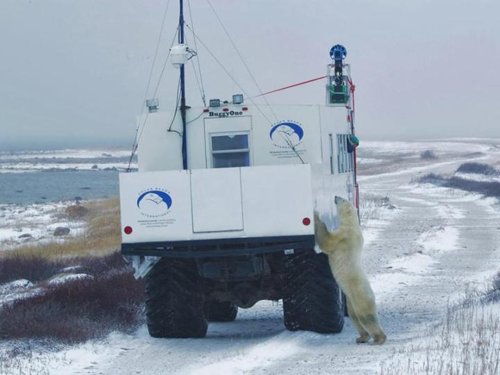
In honor of International Polar Bear day, Google has released a swathe of Street View imagery showing off the animals in their natural habitat. The remote areas around Churchill, Manitoba in Canada are now available to view in an initiative to draw attention to the effects of climate change on the region.
“The Google Maps team mounted the Street View Trekker onto a specially designed Tundra Buggy, allowing us to travel across this fragile landscape without interfering with the polar bears or other native species,” wrote Krista Wright of Polar Bears International in a post on the official Google blog. “Through October and November we collected Street View imagery from the shores of Hudson’s Bay as the polar bears waited for the sea ice to freeze over.”
Google has added the captured photographs to a dedicated Views page on the Google Maps site. As well as browsing through dramatic scenery from the region and trying to spot the polar bears in the landscape, you can also take a virtual tour of the Churchill Northern Studies Center, the Eskimo Museum, the Northern Lights observation deck and several other landmarks.
There’s a serious purpose behind the imagery that’s been collected. As Wright says: “Bringing Street View to Canada’s tundra establishes a baseline record of imagery associated with specific geospatial data — information that’s critical if we’re to understand and communicate the impact of climate change on [the polar bear’s] sensitive ecosystem. As we work to safeguard their habitat, PBI can add Street View imagery to the essential tools we use to assess and respond to the biggest threat facing polar bears today.”
Street View has expanded way beyond well-trodden streets in recent years as Google’s photo-capturing technology becomes more mobile. Mountains, airports, famous landmarks and much more besides can all be explored. The main Google Street View front page showcases some of the best locations.


