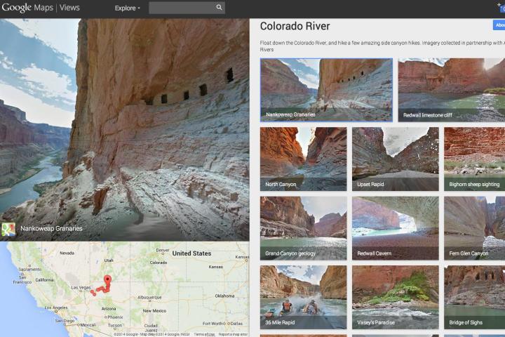
Sofa loafers looking to get away from it all – in an appropriately virtual sense – can now take a rafting trip along the Grand Canyon’s Colorado River, courtesy of Google Street View.
The latest addition to the Web giant’s fast-growing database of panoramic imagery landed on the service Thursday, the result of a partnership with nonprofit outfit American Rivers, which last year described the Colorado as the most endangered river in the US due to outmoded water management systems and persistent drought.
Consequently, it’s hoped the launch of the imagery, taken along a 286-mile stretch of the 1450-mile waterway, will throw attention on its plight and ultimately help bring about positive changes in the way it’s managed.

“Start at an iconic spot like Deer Creek Falls or North Canyon, or climb up to the Nankoweap Granaries,” American RIvers’ Chris Williams wrote in a guest post on the Maps blog, adding, “Geology fans will enjoy formations like Hermit Shale and Tapeats Sandstone. Look out for wildlife like big horn sheep and signs of a volcanic dam that naturally occurred centuries ago.”
Along the way, you can also hop off the boat and stroll along some of the side canyon hikes, if you like.
It’s not the first time the Google Street View team has taken to water. Three years ago it plunked one of its panoramic cameras on a boat and sailed down the Amazon River, posting the imagery in 2012.
As for the Grand Canyon itself, the Mountain View company added the stunning natural wonder to Street View at the start of last year after spending months collecting content with its backpack ‘Trekker’ cameras.
So, fancy a quick scoot along the Colorado before lunchtime? Just hit the link, choose from one of the many start points, and away you go (no paddle required).


