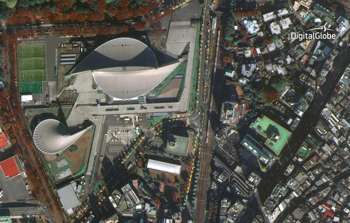
Snapped from 617 kilometers (383 miles) above Earth at the end of last month, the pin-sharp picture shows Tokyo’s Yoyogi National Gymnasium, a venue that played a part in the 1964 Olympics and which is set to see more action in the 2020 Games.
The detail in the shot is impressive to say the least, from the clearly defined lines on the soccer field to the fall colors of the trees surrounding the sports complex.
The WorldView-4 joins four other DigitalGlobe satellites orbiting Earth, each one beaming high-res imagery back to a range of clients in fields that include not only map makers but also defense and intelligence agencies, environmental organizations, and, when required, disaster and emergency responders.
The satellite’s 500-kg SpaceView 110 imaging system is the work of Florida-based Harris Corporation and features a sensor capable of capturing data points just 10 inches apart. “For example, this imagery would enable urban planners to see cities in such detail they could count the number of people in an area of interest,” Harris explains on its website.
The high-tech kit is able to gather imagery from 680,000 square kilometers (262,550 square miles) each and every day, updating and rapidly expanding DigitalGlobe’s 16-year archive in the process.
The satellite, built by Lockheed Martin, launched aboard a United Launch Alliance Atlas V rocket on November 11, 2016, setting to work a short while later. Google Maps uses imagery from several sources – while its most detailed content comes from DigitalGlobe, imagery showing broader fields of view is currently supplied by the Landsat 8 satellite.


